
After the South Takao Ridge,
we now have its counterpart on the north side. The photographs in
here come from two separate December hikes, catching the back end of
2012's autumn.
Again, you can find instructions
and details here if you'd like to attempt this one yourself. This is
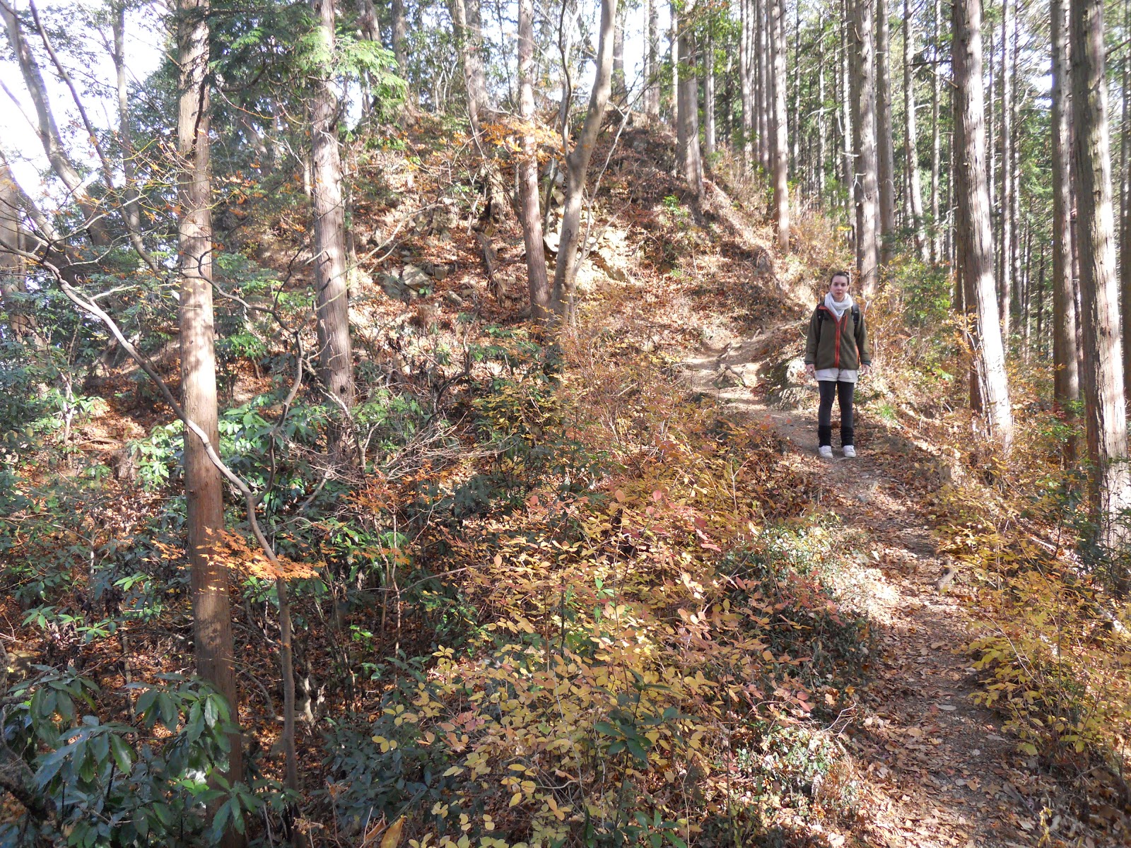
among the best so far for splendid views, as north Takao is packed
with deciduous woodland with fewer of the south's evergreen
plantations, and frequent openings provide panoramas in both
directions. To the north, Tokyo's sprawl subsides into spreading
Oku-Tama mountainscapes, while the south offers the main ridge's
colourful slopes and some impressive views of Mt. Fuji.


Be warned. This is a serious
trek, and a jump up in challenge from the south or main ridge. Though
you will not go higher than 731m, almost the entire route consists in
steep climbs or descents, alternating unrelenting. The ridge is far
less travelled than Takao itself, and there are few escape routes
should you run into trouble once on it. Treat this walk with respect:
go at a decent level of fitness, and bring a map and a compass as
well as sufficient food and water. There are no toilets, so be sure
to bear a toilet roll. And especially in winter, start walking as
early as possible, to make sure you make it down before darkness sets
in around 4:30-5pm; a flashlight is recommended just in case.
The paths are in good condition,
not too rocky and often soft. Signposting is good, despite a few
spots of confusion.
North Takao Ridge
Length:
Approx.
14km. However, it will feel like a lot longer.
Hiking
Time: Allow at
least 7-8
hours.
Height:
After
the first hour-and-a-half's ascent to 556m (starting at 211m), the
main section is an arduous 6km up and down a long series of peaks.
Eventually the ridge merges into the Takao-Jinba ridge at Mt.
Dōdokoro
(堂所山),
the walk's highest point at 731m. From there a sustained descent
returns you to the road at 237m, with a final half-hour of flat
pavement to Sagami Lake.
Access:
1)
Go to Takao
Station (高尾)
on the Chuo or Keio Line,
and go out of the North Exit.
2)
From the bus terminal there, many buses go to the Hachioji Cemetery
entrance (Hachioji
reien-mae, 八王子霊園前)
where the walk starts, including buses 1, 2 and 11. It only takes
about 6 minutes to get there.
3)
The walk ends at Sagami
Lake
and Sagamiko
Station (相模湖駅),
one stop past Takao Station on the Chuo Line.
STAGE
1
Ascent from Hachioji Castle Ruins to the shrine and Fuji Viewpoint
~2 hours, 3km
Get
off the bus at the entrance
to Hachioji Cemetery (Hachioji
reien-mae,
八王子霊園前).
Walk a few steps further to the map board, and as it indicates, turn
left at the junction ahead. Follow this road west for about 15
minutes until you reach the visitor centre for the Hachioji Castle
Ruins.
 |
|
Follow the road along 'Shiroyama River', towards the
interesting stuff in the bottom left.
|


The visitor centre (a white building) has maps
available, and some helpful staff who will answer any questions about
the route. There are toilets here you would do well to make use of.
If
you have time to spare, the castle site is an easy few minutes
through the woods beyond. Another of Japan's great 100 castles, Hachioji's
has a bloodstained history
on account of Hideyoshi's conquests that has kept its significance in
the shadows. Now in ruins with a haunted reputation, it offers some
reconstructed foundations and tranquil glades.


To
begin the walk proper, the trail up the castle mountain (Hachioji
Shiroyama,
八王子城山,
not to be confused with Kobotoke Shiroyama begins
at this gate behind the visitor centre. The sustained ascent is but a
taste of what is to come, and the trail looks out across Tokyo, whose
east side, Skytree and all, are apparent in the distance.


The top of Shiroyama is dotted with shrine buildings and
stone monuments. Look for a short slope round the back to some
haunted-looking toilets, which are the last ones you will see before
sunset.

The
path continues right of those toilets. At a fork shortly ahead, you
will want to take the misleading-looking left path that arcs back
around downhill (but there is another fork where you ignore the much
steeper left path, and go right! A compass is useful here). You are
on the right track when you pass a water pump on your right; some
more uphill waits ahead. Your goal is the Fuji Viewpoint (Fujimidai,
富士見台).


STAGE
2
Along
the ridge, from Fuji Viewpoint to Mt. Dōdokoro
~3-4 hours, 6km
This
is where it gets real. If you are worried about fitness, time or
supplies, this is your last straightforward chance to get down: go
across the peak past the picnic table for a path that eventually
doubles back to Takao station. Otherwise,
note the signpost above and follow the path on the right, towards Mt.
Dōdokoro
(堂所山)
at 6.0km.
Now
comes the fun part. From here to Dōdokoro,
the ridge undulates up and down a good dozen peaks. Expect some slow
and rigorous hours overcoming steep ascents, and coming down the
other side only to find even rougher climbs in front of you. No rise
or fall lasts more than a few minutes, but the sheer relentless rate
at which they come is this hike's primary challenge. Pace yourself
well.
It is hard to get lost: there is
only one path, and signs reminding you of your goal are quite
frequent. You will probably want to stop for lunch on the way. And
whenever you stop for breath, do not forget to appreciate the
peaceful tranquility, colours and views on both sides that you might
overlook in exertion.


Eventually
the path descends on a wider dirt road, with signs and a map to the
left. The road trails away to the north side, so keep to the path
along the left, as you want to stay on top of the ridge. After a few
more peaks and burning calories, you will come a peak labelled
“circle of cedar trees” (Sugi
no maru,
杉の丸).


 |
|
Path on left, road on right. Stay
with the path.
|
 |
|
Sugi no maru
|
Getting
this far indicates good progress, but you're not there yet. A good
hour or two more of the same remains before you finally reach Mt.
Dōdokoro
(Dōdokoro
Yama,堂所山),
the final significant uphill of this course.
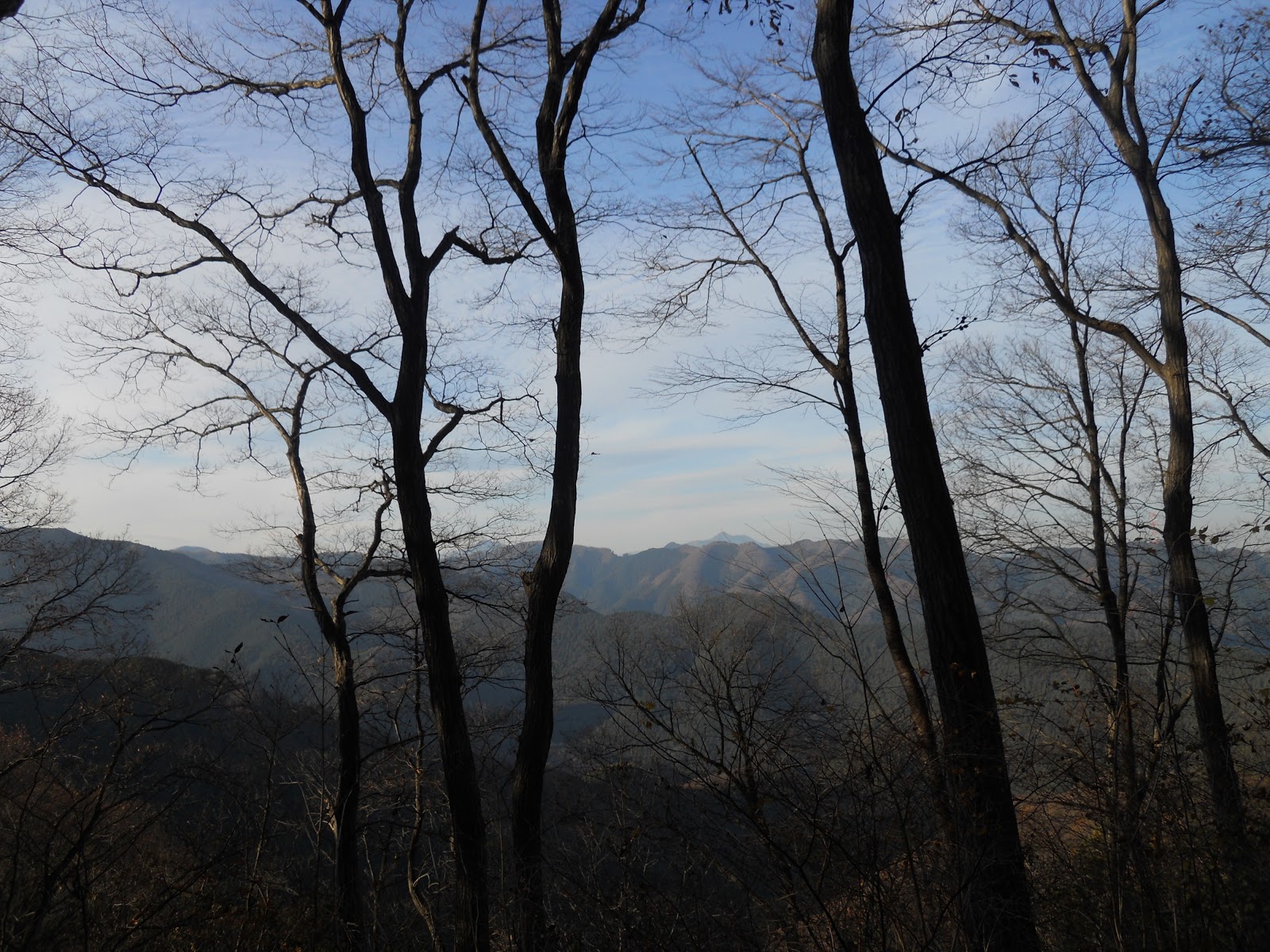
For most of this section the
views look north, towards the mountains of Oku-Tama, illuminated by
the declining afternoon sun.


STAGE 3
Down
from Mt. Dōdokoro
to Sagami Lake
~1.5-2 hours, 5km
From
here you rejoin and cross the main Takao-Jinba ridge, and descend
into Kanagawa prefecture. Turn right past Dōdokoro
for an easy ten-minute stroll to Sokosawa
Pass (Sokosawa Tōge,
底沢
峠).
It is not labelled as such, but is not as far as Myōo
Pass (明王峠)
and has a left turning signposted to Sokosawa (底沢).
From here it's downhill for almost all of the way, till you come to
some houses (including an onsen), roads, and the towering Chuo
Expressway far overhead.
You want to make it at least this
far before it gets dark, lest you be stranded and freezing on
pitch-black slopes overnight. If you've reached this point,
congratulations: all the hard parts are done.

 |
| Bamboo after turning down off the main ridge |


Follow
the signs just a bit further to the Sokosawa bus stop, where if
you're at your limit, you can wait for a bus to take you the last
kilometre-and-a-half to Sagamiko
Station (相模湖駅).
Of course, walking it lets you fulfil a proper sense of completion,
and it's only about 30-40 minutes further along well-lit pavement,
with vending machines and food outlets along the way. Once in the
village, follow the road signs for the train station; those
masochistic enough can instead turn left and downhill (and thus up
again after) for the lake, which though famous and beautiful, will be
lost to sight in the darkness by the time you reach it.
 |
|
The bus stop is right next to
this bridge, across the road. From the direction you come, Sagamiko
is to the right.
|


This may be about as challenging
as Tokyo-area hikes get, short of 1000-2000m mountain territory, and
provides a good test for anyone of average fitness. But so long as
you go in decent condition with appropriate planning, clothing,
food/drink and basic gear, it is definitely surmountable. The rewards
of peace, satisfaction, good exercise and splendid scenery are well
worth it.
No comments:
Post a Comment