
In Japan,
where coherent seasons are culturally meaningful and still in fact
exist, kōyō
(autumn colours) are to this time of year what sakura are to spring.
Temperatures fall, and a cooling wave sweeps the green of the trees
into reds and golds, progressing south as winter approaches.
It is a fine time to hike. The
summer inferno has passed while the freezing bite of winter is yet to
come, and clear skies are frequent. Here is the first of several
examples: the Sengen Ridge, out west of Tokyo in the Akiruno
(Akigawa/Itsukaichi) area. Another, the South Takao Ridge, will
follow on here shortly, with likely more to come after that.

Sengen Ridge
Length:
Approx. 10km
Hiking
Time:
4-5 hours
Height:
Up to 890m, starting from 255m. Early ascent (occasionally steep) is
followed by relatively level and gentle paths along the ridge until a
steep descent at the end.
Access:
1)
Go to Haijima
Station
(Ōme Line from Tachikawa, or Hachikō Line from Hachiōji, both
short distance), then change to the Itsukaichi
Line
to MUSASHI-ITSUKAICHI
STATION
(also short).
2)
From Bus Stop 1 outside the station, take bus No.10 to Hossawa
no Taki Iriguchi
(Hossawa Falls entrance) – 22 minutes, 460 yen. The walk begins
from that bus stop.
Note that the buses on this route
(which you come back by afterwards too) come about once an hour. I
recommend an early start, given that broad daylight starts around 6am
at this time of year, and sunset already approaches after 4pm. Plan
and time your hike well, and as with all adventures, bring a map and a compass.
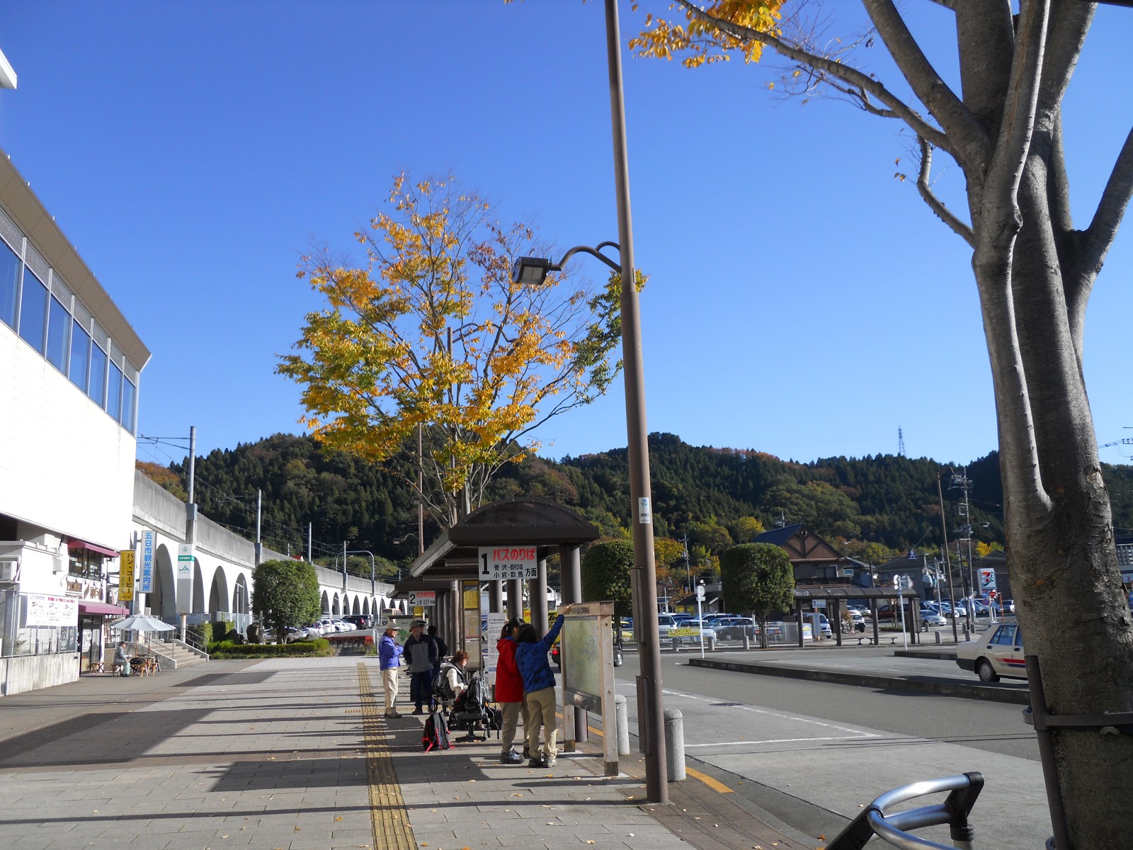 |
| Musashi-Itsukaichi station. The bus departs from this stop. |
 |
The ridge is in grey: the hike
goes from east to west. If at any point you start dying, there are
plenty of retreat options down to the bus routes, in blue.
|
This is a pleasant walk up and
along a ridge through forests and plantations. There are good views across valleys and slopes, sometimes panoramic over surrounding mountain ranges. Though it can get steep at the
beginning, it is smooth for the most part, and not too challenging at
a reasonable level of fitness. It is less crowded, and more peaceful,
than some of the more popular hiking spots in the region.
Though quiet, it is a populated area, with houses and a few eateries or tea houses near the
beginning and end. Bear in mind that there are few toilets – though
unlike the crowded hikes near Tokyo, there are plenty of places you
can get away with making your donations to the foliage.


 |
| 'This office must request that all FOREIGNERS obey these rules'! |
There
is a short (30 minutes) and worthwhile detour at the start: to and
from Hossawa
Falls
(払沢の滝).
The path there and back is easy and well signposted: look out for
those kanji.
 |
| Hossakwa no Taki Iriguchi: the start point. Go left! |


The route proper begins from the
bus stop. In all, there are three general phases.
1)
The ascent from the waterfall entrance bus stop to Sengenrei
(浅間嶺).
Follow the signs there, via Tokisawa Pass (時坂峠).
This is mostly uphill for about 2 hours, alternating between roads
and paths. There are houses dispersed around the route until you get
up around halfway. This is the most physically demanding part of the
walk, but offers impressive views across the valleys.


The actual peak of Sengenrei
itself is not accessible: but you will know you are near when the
signage gets a bit confusing. What you are looking for is a shelter
(with benches, maps etc.) next to a small clearing, from where you
get this lovely panorama to the north. This is a good place to stop
for lunch.

2)
The next (and main) portion goes along relatively level paths through
the trees. Some of these are narrow or slightly obscured by fallen
leaves, but with a modicum of sense and caution ought not to be a
problem. From Sengenrei, look for a very short and steep ascent just
past the shelter up to a little peak with a shrine. There is a path
to the left (which may be hard to spot) that goes around behind it.
From there, follow the ridge and signs to
Henbori
(人里
)
Junction,
then Kazuma
(数馬)
Junction.
 |
| The spiritual installation at Sengenrei. A path beyond is hidden on the left. |


This section takes around another
couple of hours. You will know you're on the right track when you see
this fine patchwork in the distance, where evergreen plantations
jostle with deciduous woods.

Along the way there are numerous
junctions, offering paths down to the road at the bottom of the ridge
and its bus stops. Any of these lets you get on a bus back to the
train station, if circumstances require you to finish sooner than
planned. Look out for this statue shortly before Kazuma junction.

3)
At the Kazuma fork you have two options. Either take the left path,
which soon begins to descend; after 30 minutes or so you pass a tea
house and make it back to the road. A few metres to the right, next
to the noisy logging facility, is the Sengen
onetozan guchi bus stop,
from where you can take the bus back east (parallel to the way you've
hiked) to Musashi-Itsukaichi station. From this stop it takes 48
minutes and costs 870 yen.
Alternatively, if time and energy
suffice, you can take the right path and continue along the ridge.
The next junction is 15 minutes on, from where another path goes down
to the same bus stop. Or you can go an hour or two further, and come
down at subsequent junctions to bus stops further along the same
route, if you so wish. Eventually the ridge curves north into
Okutama; just be sure to get down before it gets dark.


Watch this space for information
and photos for the South Takao Ridge in due course.
No comments:
Post a Comment